Expert warns of maintaining healthy online hygiene
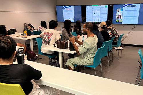
Similar to what you would hear at a dentist office, Liam Wesley dispensed advice about the importance of daily hygiene during a Cybersecurity Workshop at the Data Science Center in Tredtin Hall. But for the cybersecurity expert, this means never using the same username nor the same password ever! Just like you would never keep using the same strand of floss.
In an era dominated by digitization, Wesley described the importance of robust cybersecurity measures that cannot be overstated. As online users navigate an increasingly interconnected world, the guardians of our digital realm are facing new challenges and adapting strategies to protect against evolving cyber threats. Wesley is among them fighting the digital perils.
The 90-minute Cybersecurity Workshop was hosted by the National Science Foundation ALL-SPICE Alliance, which includes the United Nations CIFAL CENTER of Honolulu, Information Technology and Services Department (senior director Jules Sukhabut), the Networking Department (director Joseph Rosario), Data Science, Analytics and Visualization Program (director Rylan Chong, Ph.D.) and the Computer Science Department.

“We brought in Liam to demonstrate real cyberattacks, and discuss how a student can protect themselves for educational purposes and build awareness,” said Chong, Co-Principal Investigator of the National Science Foundation’s Alliance Supporting Pacific Impact through Computational Excellence (ALL-SPICE) grant. “Joe and I plan to pilot this cybersecurity workshop to Natural Sciences and Mathematics students to gauge interest. This will help us understand if there is interest for future workshops, larger workshops and/or a need for a cybersecurity course or program.”
Cybersecurity experts, like Wesley—a penetration tester and cybersecurity engineer with High Tech Hui, LLC and Cyberruptive—warn of the escalating sophistication of cyber threats, ranging from ransomware attacks that cripple essential services to targeted phishing campaigns exploiting the remote work landscape. The proliferation of Internet of Things (IoT) devices—AI voice assistants like the Amazon Echo and Google Home—coupled with the rise of artificial intelligence in cyberattacks, adds a layer of complexity to the battlefield.
In the face of these evolving threats, organizations are doubling down on best practices to fortify their defenses. This includes regular employee training to recognize and thwart phishing attempts, implementing multi-factor authentication, and keeping software and systems up-to-date with the latest security patches.
“Patching is absolutely necessary,” Wesley said. “But wait a few days to avoid the potential for buffer overflow, which are memory storage regions that temporarily hold data while it is being transferred from one location to another.”
Initially limited to Rosario’s computer science networking class, the workshop was eventually opened to all Natural Sciences and Mathematics students due to the importance of the topic and the large interest from Chong’s previous presentation on the topic.
One of the workshop’s primary goals was to bring awareness and introduce education innovation. Chong explained that the topic is very important for the University’s DSAV, CS and NSM students, as many of them are doing research, working with data and sensitive data at various organizations for jobs and internships, and using computers.
“Instead of traditionally just bringing in someone to talk about cybersecurity in general, our goal was to make this relevant to the students to build awareness, address on the national security level the lack of cybersecurity education in schools, and an approach to work on better securing our campus,” Chong said. “In addition, we are planning to take an innovative educational approach by actually demonstrating how easy it is to hack and simulate how bad a cyberattack can be to an organization.”
The landscape of cybersecurity is indeed dynamic and ever-evolving. Experts agree that a collaborative, proactive approach—comprising technological innovation, regulatory compliance and ongoing education—is essential to safeguarding our digital world against the relentless tide of cyber threats.
“There was a lot of information, which was hard to keep up with,” said data science and visualization major LaVelle White ’26. “He explained pretty well how hackers get into systems, even though I can’t hack, but I understood the concept.”


